Simultaneous Stories So Far...
Urban Assemblies: the vacancy Phenomenon
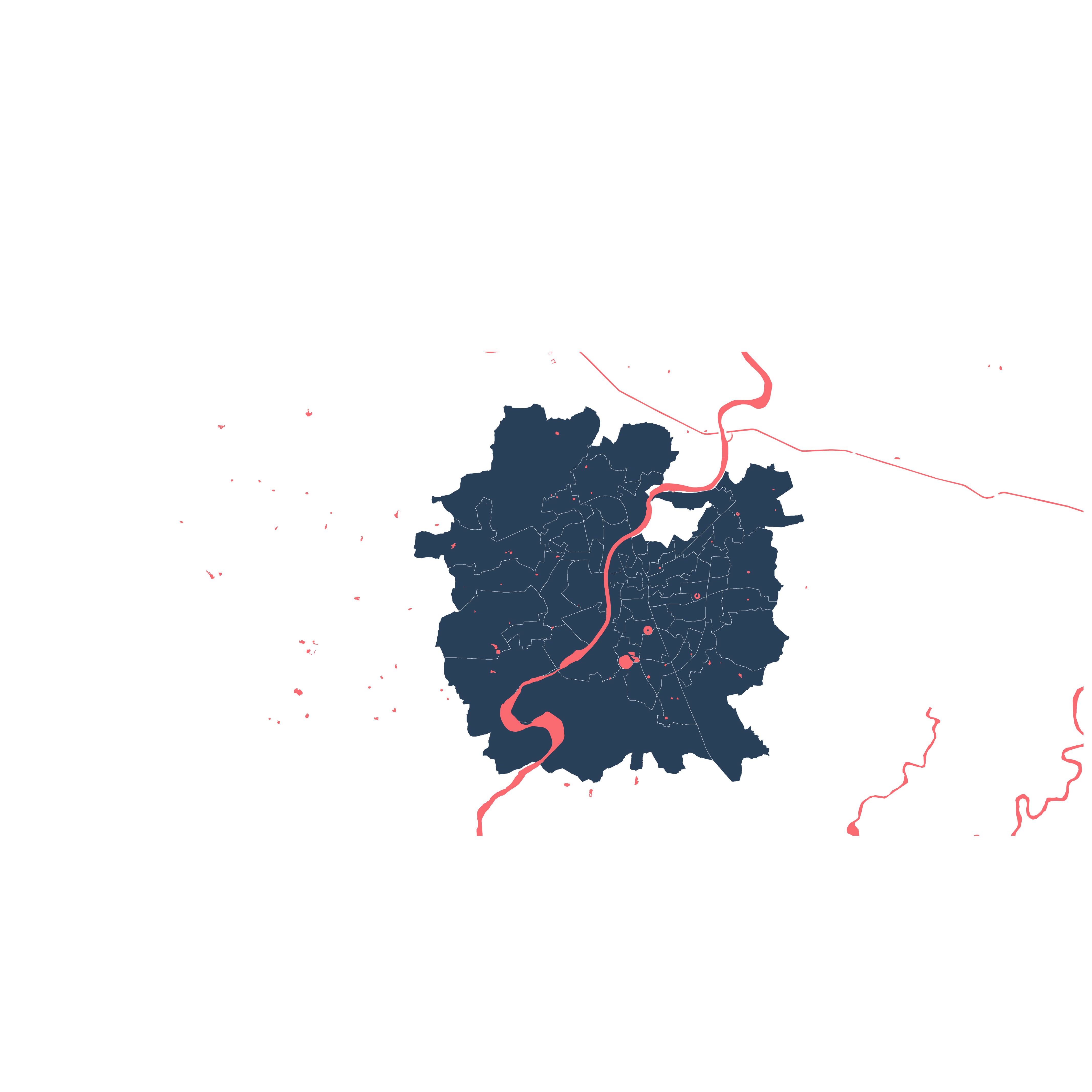
Greenbelt of Ahmedabad
Planning process byproduct
Story so far

Urban Assemblies 1.0
Drawing on Vacant Land
This studio approaches design intervention as a tool for engaging questions of urbanism. Juxtaposing theories of terrain vague and field urbanism with a critique of modern city making, the design of a government civic center is used to interrogate the current rift between officially sanctioned public spaces and the public’s use of vacant land.
Ahmedabad is full of vacant lands, both public and private, whose surreptitious adoption as spaces of play supplement publicly accessible large open places, which are too few for the city’s population. This ungainly setup – an abundance of loosely organized vague space – pairs littered boundary walls and abandoned buildings with lively rounds of cricket, and sits alongside poor quality public space and a dearth of parks.
Because these vacancies exist among simultaneous density, many of the so-called vacant lands are temporarily occupied – in use while waiting for an “official” function – a better market for development, the resolution of a conflict of claim, or the expanding needs of the municipal bureaucracy.
Occupiers fearlessly sweep under barbed wire, make holes in fences and hop boundary walls to takeover the space inside. Couples find private islands of calm, friends chat on bikes, and on Sundays and in summer vacation, hoards of young men and children surge onto open grounds for match after match of cricket.
Although unofficial, the activities supported during this waiting period are actually vital for the social life of the city. (Cricket! Driving Practice! Festivals!) And because the land on which they play out has been effectively removed from the market, these tracts provide a necessary alternative to the inequitable distribution of space in a city where land cost is high, speculation rampant, and public services inadequate.
But the condition is temporary; eventually these lands are put to use. New programs replace the activated space, and the actors are forced to search for another site.
What if, instead of erasure, the new programs were imagined alongside current occupations, and official functions were layered with unofficial ones? As TP Schemes in the city are made, plots are set aside for municipal use. Though they technically belong to the public, rarely are the public allowed to access. This studio turns that relationship on its head. Using the mapping of space activation through careful analysis of the sites as-found, the lessons of possibility and of engagement are applied to a new municipal civic center for an Ahmedabad Ward, imagining it on a site that mediates public engagement, not only in terms of the role of the building, but also in terms of the site itself as a resource for unplanned activation.
The work represented here is a continuation of a series of studies engaging the condition of vacancy in the densely populated and growing Indian city, one which is not uncommon yet is rarely examined. By making mappings of- and by participating in- activities on ground, we examine how tactics of temporary occupation are used to lay claim to and transform otherwise overlooked space.
We take the position that the result of the vacancies is not that of neglect necessarily; rather they are opportunistic spaces, which by virtue of their vague legal status allow realities to play out that need not adhere to the heavy-handed commercial transactions of urban land economics. They support an alternate reality in the space of the city, where access is determined not by money but by engagement and claim; where direct negotiation supplants the down payment of capital, and outsiders find a way in.
Reading the Sites

The sites have been chosen as a representative cross-section of the scales of vacancy in the city. Ranging from the ubiquitous municipal utility plot to the singularly large hostel ground, the sites vary significantly in terms of their relationship to their surroundings, and their prominence in the city, yet the immediate tactics of engagement are similar in all.
a. Naranpura: Municipal Owned Site
b. Naranpura: former Greenbelt Site, Mixed Ownership
c. Naranpura: Cricket Ground, Municipal-Owned Site
d. Navrangpura: Municipal-Owned Vacant Site
e. Naranpura: Gujarat Housing Board Common Plot
f. Navrangpura: AES Hostel Ground, Mixed Ownership
g. Manekbag: former Greenbelt Site, Privately Owned


Proximity
Land parcels and Vacant land parcels in proximity to BRTS, Metro project and Public Gardens are identified. A buffer zone of radius 400m is used to identify these sites and to understand overlaps, inter-changeability and direct connect or reach of these infrastructure to the city. The closer the site to these infrastructures, the more the flows around it.
Furthermore the gardens are identified and a buffer of 500m is created to represent its neighborhood reach.Then the vacant lands are proposed as gardens to speculate upon the impact on the city and its neighbourhood to further stress the importance and latent potential of the vacant land parcels. This is representative map that suggests so many other possibilities for these vacant sites as points of urban interventions.
Proximity to Public Gardens and Other Vacant Lands

Proximity to Public Transportation

Similarity
Similar sites falling within the range of area close to the individual sites are identified to recognise its conditions, use, and type. This is done in two parts. First is similar sites in the vacant sites list and the second is in the TP. list, i.e. the existing built or to be developed sites.
which in turn gives clues to how the city uses and perceives these sites as well as patterns that inform and opens up the future development to opportunities or interventions.


Drawing on Vacant Lands
We alternate between two modes of engagement with the site: mapping and designing. We use these tools to examine urban conditions and critique, the situations and processes that produce them. In this studio, both design and mapping are used as tools for interrogation, not as end results.
01. Mapping
Reading and Recording the Site | Field Actor Sense Synthesis
The students examined the site as-found and interrogated the means by which the current situation has been produced, the relationships that support it, and the issues that threaten it. For each site, maps were created at two scales, one looking at the city extent, and one at the details of the site that characterise the FIELD, the ACTORS and the SENSE of the site. These mappings are synthesized into drawings and working models of the sites that selectively visualise the relationships that the mappings have uncovered. These mappings show the site in 3 distinct conditions: typical day, weekend day, and festival day.
FIELD - the built form of the site and the area surrounding it, including ground, buildings, landscape, infrastructure- everything that is immovable.
ACTOR - beings that move in, out, and around the site, or otherwise impact the site through their actions. (These can be human or nonhuman, even conceptual).
SENSE - the characteristics or qualities of the site which are derived from the relationships among the field and the actors.
02. Design Propositions
Radical Interventions | Concept Initiation
The students have placed themselves in the role of “architect for the municipality,” and to use the fulfilment of a design brief for the municipality as a means to interrogate the nature of the architectural intervention and the impact that it has on the site.
The work of architecture is to make new buildings in empty spaces. Whether we tear down what existed, occupy or simply ignore it, in order to construct, we first become agents of destruction. In this instance, what exists must be engaged. On the given sites, students have inserted a new Municipal Civic Centre, which serves the surrounding neighbourhood/ward. The building needs an area accessible to the public, an area for internal office work (inaccessible) and
an interface between the two. The designs take a position with regard to the field of the site, and actors already at work, for example, whether to uphold, engage, preserve or alter them.


Naranpura Market
Bakda Under a Tree
Naranpura Public Ground
The Gate
Old Tibetian Market
Terrain Lab
Manekbaug Private Ground
Pathwaves


Shastrinagar Housing Area
Sahiyaru Patangan
AES Ground
Re-defining the Edge
AES Ground
The Shade
Northern Green Belt
The War of Narrative
STUDENTS: FACULTY OF ARCHITECTURE, CEPT UNIVERSITY
Astha Shah
Avni Suthar
Harsh Parmar
Harshit Vaja
Krupa Patel
Ravi Makwana
Sadik Agaria
Tanvi Patel
TEACHING TEAM:
Melissa Smith
Bulbul Vyas
Alisia Tognon