Simultaneous Stories So Far...
Urban Assemblies: the vacancy Phenomenon
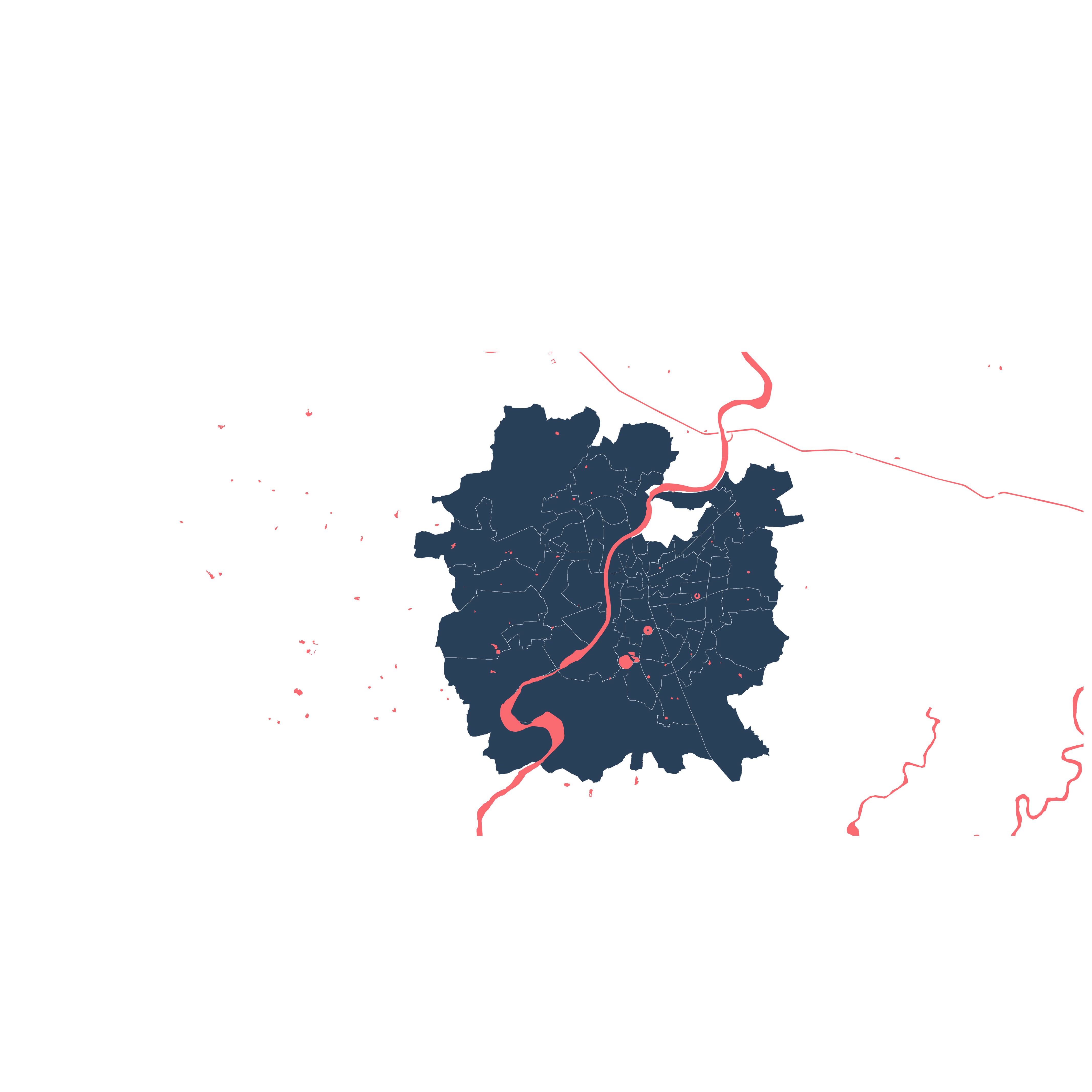
Greenbelt of Ahmedabad
Planning process byproduct
Story so far

Finding Vacancy

Ahmedabad is full of vacant lands, both public and private, whose surreptitious adoption as spaces of play supplement public parks, which are too few for the population. Occupiers fearlessly sweep through barriers to take over space inside. Couples find islands of calm, friends chat on bikes, and on Sunday, hordes of boys surge onto open grounds for match after match of cricket.
Part of a failed greenbelt uncarefully planned in 1965, a ring of properties laid legally vacant for nearly fifty years while their owners fought proposed restrictions in court. Meanwhile, the city grew and the string of space bloomed into an intermediate strip of wild, growing out from the river and rounding back to it. In 2013, the case was decided against the greenbelt; now it is awash with new construction. Contested bans like this, along with a mosaic of government actors, family disputes, and extended court cases produce an abundance of loosely organized vague space within the boundaries of the city.

Various types of activities and users occupy the vacant land in Vasna
Yet the vacancies don’t necessarily cause neglect; rather they are opportunistic; their vague legal status allows realities to play out that need not adhere to the heavy handed commercial transactions of urban land economics.
Because they exist among simultaneous density, many are temporarily occupied while waiting for an ‘official’ function. Although unofficial, their activities are vital for the social life of the city. (Cricket! Couples! Festivals!) And because the land on which they play out has been effectively removed from market, the tracts provide a necessary alternative to the inequitable distribution of space in a city where land cost is high, speculation rampant, and public services inadequate. They support an alternate reality where access is determined not by money but by engagement; where direct negotiation supplants the down payment of capital, and outsiders find a way in.

A cricket match during a weekday evening at LIC Ground, Ambawadi


Parks and Gardens

Institutions

Common Plots

Green Belt

Other Public Vacant Lands

Infrastructure

Party Plots

Other Private Vacant Lands

Cricket related activities amidst Tibetian Market setup at Old Tibetian Market, Helmet Cross Road
This URP proposes to generate a catalogue of vacant spaces in the city and their uses which evaluates the extent to which private vacant spaces supplement public open space.
It builds on existing work which maps the activities present in vacant, non-street plots in the central-western areas of Ahmedabad. A broad survey of sites across the city is generated through the compilation of TP Scheme plans, DP land use plans and satellite imagery, cross-referenced with a primary survey, in order to extend a GIS database already developed for central-western Ahmedabad. The total private and public vacant land areas, as well as their median plot sizes, are compared, and a detailed study of how similar uses play out on a set of representative sites will explore the structures of social organizations that control temporary uses.
The research focuses on using the database to analyze broad trends present in the city, and to identify and study a set of case studies in greater depth. The broad analysis aims to quantify how much private land is used for recreational or other quasi-public purposes, versus how much public land is allocated for similar activities, and to examine a comparative distribution of lands. Detailed Case Studies examine the demographics of the users on representative sites, as well as the stakeholders and social structures that govern their operation. Detailed site studies are analyzed for comparison, in order to identify trends that are present across different types of site or area, in comparison with particular organizational structures that emerge for one type of site. This analysis can be used to test the findings of the broad survey.


The drawn catalogue maps the varied vacancies across the city, and diagrams typological patterns that emerge, with particular emphasis on variation between publicly owned, publicly used space, and privately-owned “publicly” used space. By representing the active engagement of citizens with land that is considered off-limits, this project aims to both quantify the extent of non-street land parcels that are currently in use, and qualify the nature of engagement between the users, the owners, and the public.


Mapping of Naranpura Ground by Astha Shah, Urban Assemblies 1.0
Mapping of Memnagar Lake by Parth Patel, Urban Assemblies 2.0
Vacant land in Vasna, by Mandeera Baghar, Urban Assemblies 2.0
'Vacant Lands in the Dense City' catalogues the ways in which private vacant lands supplement public land for public purposes and may also demonstrate these trends and suggest avenues for policy innovations. It reflects a long running project, which has already supported 5 courses over the past five years: an Archiprix Workshop “Vacant Lands in a Dense City” (2017), a CEPT Winter School course in collaboration with Kingston University, “Ahmedabad POPS” (2017) and three CEPT L3 studios “Urban Assemblies: Drawing on Vacant Lands” (2019), "Urban Assemblies 2.0: Radical Interventions in Loose Public Space" (2020) & "Urban Assemblies 3.0: The Vacancy Phenomenon" (2021). It serves to facilitate academic courses at CEPT: running parallel with the CEPT L3 Studio “Urban Assemblies” (a continuing studio), and a proposed Summer School, “Comparing Urban Vacancy” in collaboration with the University of Michigan.